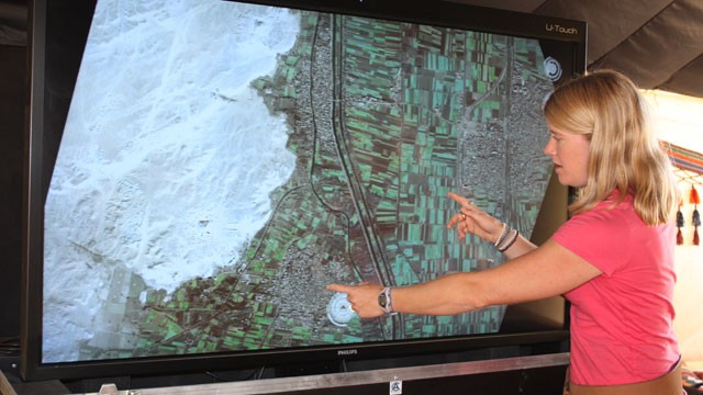
To find the ancient Egyptian city of Tanis, Indiana Jones had to confront snakes and outsmart Nazis. Archeologist Sarah Parcak had it easier.
With satellite imagery (and more than a decade of experience), Parcak uncovered not just Tanis, but as many as 17 lost pyramids and thousands of tombs and settlements buried under an Egyptian floodplain.
"This just hints at the possibilities and the potential of the archeology of Egypt," said Parcak, an Egyptologist and assistant professor of archeology at the University of Alabama at Birmingham. "There's just so much there."
Funded with a grant from the BBC, which will air a documentary on the project next week, Parcak and her team spent more than a year poring over NASA and commercial satellite imagery of Egypt's Nile Valley Delta -- an area that covers thousands of square miles.
By looking at images of the surface in different wavelengths of light, they discovered differences on the ground that reveal the presence of ancient temples, houses and pyramids.
"All of a sudden, these features jump out at you," she said. "It's almost like you've got Superman or Superwoman X-ray vision and you're able to look at the world a little differently."
When you walk on the ground over an Egyptian floodplain, Parcak said, you can't see much more than a brown, silty surface. But pictures from satellites about 435 miles above Earth show the chemical changes in the soil caused by the mud brick walls used to build the hidden structures.
Satellite Imagery Lets Archeologists Peer Beneath Earth's Surface
Though the imagery showed a treasure trove of ancient antiquities buried 8 to 20 inches below the surface, Parcak emphasized that excavation or ground surveys still need to confirm their existence. But initial excavations have already validated some of her findings, including one pyramid.
Parcak said the idea to harness satellite technology came from her grandfather, a forestry professor who pioneered the use of aerial photography in his field.
"I grew up thinking that was just the coolest thing in the world because of my grandfather," she said.
When she got to college and started looking into applications of the technology in archeology, she said she found that very little work had been done.
Especially in an era of budget cuts and reduced travel, Parcak said her project shows that satellite technology can help archeologists explore remotely, strategically and more efficiently.
"I don't know that we have to think about excavations all the time," she said. "We can use the technology to help us zoom in on certain parts of sites."
Ultimately, Parcak said, satellite technology's greatest contribution to archeology is the breadth of information it's able to uncover more quickly.
By giving scientists an overview of a geographic area, it lets them turn their attention to the people and society that lived there, she said.
"To me, the most important part of ancient Egypt is the people," she said. "This information will hopefully allow us to ask different questions."


0 comments:
Post a Comment